| ABOUT | ARTICLES | FORUM | RESOURCES | GALLERY | CROSS |
|
|
|
|||||||||||||
|
||||||||||||||
|
Talk about this article... Desolation Canyon: History along the Green River November 13, 2007
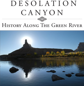
Desolation Canyon is part of a canyon/river system in one of the most remote sections of Utah. The Green River cuts a 118-mile, serpentine swath through part of a larger geomorphic unit called the Tavaputs Plateau. It creates a north-south running canyon with east-west drainages. At its deepest section, the river is more than 5,000 feet below some of the wildest country in the lower 48 states; in places it is deeper than the Grand Canyon. The region's massively crumpled topography of steep canyons and deep ravines is topped with hundreds of square miles of evergreen forests. Because the region is remote and protected by such daunting ramparts, it is rich in wildlife, from flying squirrels to black bears. While some canyon systems of the Colorado River Basin are more difficult to access, Desolation is not an especially inviting place. The rugged terrain and aridity associated with the river, plateau, and canyon have discouraged large scale settlement. Yet people have come to the canyon for over 12,000 years. The area preserves evidence of a wealth of human history, from prehistoric granaries to early twentieth century ranches, ferries, and moonshiner's cabins. Thus, in many ways for various peoples over the millennia, Desolation Canyon was the last best place. Our story of Desolation's history will divide into five chapters: natural history, prehistory, exploration, settlement, and the federal government. While this book does not qualify as an environmental history per se, the river and canyon figure prominently in understanding the history of the area. This book will tell the story of all those peoples who have come and gone over the millennia. It will illuminate how they made a living in a canyon system that did not possess natural resources in abundance like other places in the West--grass and/or minerals. Yet it had enough of those to attract individual entrepreneurs. In some instances, however, that remoteness worked as an asset for those people; in other instances it doomed their operations. The attraction of the canyon has always been its water, both in its mainstream channel and in its side-canyon streams and dry washes. The Fremont people, in particular, used the river and drainages for growing food and storing it. The Ute Indians who succeeded (or may have been) the Fremont also were attracted to the water, but especially to the game which used the canyon and side canyon system. While no large Ute villages were nestled down in Desolation, the Utes' presence there in the prehistoric and early historic periods was significant. The exploration of the Green River and Desolation Canyon was part of the larger saga of the exploration of the Green and Colorado River system beginning with the famous fur trapper William Ashley, continuing with such explorers as John Wesley Powell and subsequent government surveys, as well as adventurer/trappers like George Flavell and Nathanial Galloway. Many explored the canyon to exploit its animals; some surveyed it to serve as a transportation corridor; and some traveled the canyon with the idea of damming it for irrigation and power. Nothing ultimately came of any of these various exploitive ventures. The adventurers, however, were the first wave in what has become the major use of the canyon: recreational river runners. The first Anglo settlers in the area were cattlemen and cattle rustlers--the two going hand in hand. A number of ranches such as McPherson's Cradle M and the Seamounts' Rock Creek Ranch operated within the canyon and around its edges. The ranches which coexisted with, then succeeded the outlaws, were part of an unusual settlement pattern in Utah. All were pioneered by non-Mormon individuals outside the village pattern that characterized most late 19th and early 20th century settlement in the state. A combination of events such as the Great Depression, the Taylor Grazing Act of 1933, the Indian Reorganization Act of 1934, and World War II led to the establishment of more federal government control over the river corridor and surrounding lands. The Bureau of Land Management, the Bureau of Reclamation, the Uintah-Ouray Ute Tribe, and the U.S. Fish and Wildlife Service all have sometimes competing jurisdictions over the river. Issues such as river recreation, endangered species, wilderness, hydroelectric power, cultural resources, and hydrocarbon extraction all play out in Desolation. It is a microcosm of the conflicts going on elsewhere in the federal-land-concentrated West. Desolation is one of the wildest rivers in the West. Certainly humans have altered some of the natural patterns of flora and fauna, and our book examines these changes. Yet despite a fair amount of use and comings and goings by humans over the many millennia, the riparian corridor retains its wild and pristine qualities. Ultimately, however, the focus of the book will be on the various attempts to make a living in this rugged place and the very human stores behind those attempts. Likewise, the book will look at the hows and whys of this region's abandonment and what its future is as a de facto, federally managed wilderness. ALSO BY JAMES ATON
Talk about this article... |
| ||||