
| ABOUT | ARTICLES | FORUM | RESOURCES | GALLERY | CROSS |
|
|
|
|||||||||||||
|
||||||||||||||
|
Talk about this article... Part One: Citizen and Professional Science in Glen Canyon National Recreation Area November 01, 2022 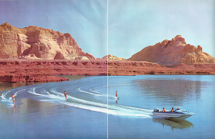 Photo above from Lake Powell: Jewel of the Colorado. Floyd Dominy; DOI, 1965.
THIS IS PART ONE OF A THREE PART SERIES
Note: this webpage is designed for a browser called Safari and a modified UNIX operating system developed by Apple Inc.; it is a browser that automatically opens files and provides responsive streaming services. We also recommend high speed internet services to avoid lengthy download times. The target for our imagery is to provide the best possible resolution. The browser called Firefox is also a recommended browser for this website. ________________________________________________
PRIMARY RESEARCH DOCUMENTS
________________________________________________
PROJECT PROGRAMMING 2002
Progradation of sediment deposits at Lake Powell
________________________________________________ STREAM GAGE: above the Dirty Devil RiverColorado River Bridge by US Geological Survey
Measures daily flow volume and river elevation. A river flowing on reservoir sediment (Lake Powell)
NEWS, ANNOUNCEMENTS AND SPECIAL FEATURES
RESERVOIR ELEVATIONS _____________________________________________ Salt Lake Tribune
National Park Service
High Country News
Utah Guides and Outfitters
Colorado Plateau River Guides __________________________________ ARCHIVES
_________________________________
Soon to arrive
_________________________________
THE DIRTY DEVIL RIVER
From the diary of John Wesley Powell at the beginning of Glen Canyon: July 28, 1869...we discover the mouth of a stream which enters from the right. Into this our little boat is turned. The water is exceedingly muddy and has an unpleasant odor. One of the men in the boat following, seeing what we have done, shouts to Dunn and asks whether it is a trout stream. Dunn replies, much disgusted, that it is "a dirty devil"...
_______________________________
BOAT RAMP CONDITIONS AT DIRTY DEVIL RIVER TAKE-OUT
Glen Canyon National Recreation Area (GCNRA)
Dirty Devil River Primitive Boat Ramp (sometimes called North Wash) and near (opposite shore) the defunct Hite Marina facility (defunct as of 2003).
Citizen Monitoring @ Dirty Devil Take-out
_________________________________________________ RESERVOIR CONDITIONS NEAR 3520 FEET: Dam and facilities March of 2022
March of 2023
_______________________________________ THE "MUD RAPIDS" AND THE "DELTA"At reservoir elevation 3530 feet
Matching photos from the Nielsen Collection near Farley, White and Trachyte canyons
___________________________________ NEWS: RESERVOIR FACILITIES AT GLEN CANYON NATIONAL RECREATION AREA (GCNRA)
______________________________ SATELLITE IMAGERY & MAPSGlen Canyon National Recreation Area (GCNRA)
___________________________________________________________ A HISTORY: Citizen and professional science related to significant low reservoir levels at Glen Canyon National Recreation Area (Lake Powell). Glen Canyon National Recreation Area (GCNRA) includes: (1) The lower half of Cataract Canyon below Big Drop Two, which is also the end of Canyonlands National Park (CANY).
The Filling Criteria for Glen Canyon Reservoir (Lake Powell)
Publications during the filling criteria for Lake Powell
Geographic Details: (1) The northern boundary of Glen Canyon National Recreation Area (GCNRA) begins at elevation 3715 feet on the Colorado River in the middle of Cataract Canyon. This elevation corresponds with the height of the concrete parapets on the crest of Glen Canyon Dam. This elevation occurs at a rapid known as Big Drop 2. The southern boundary of GCNRA occurs below Glen Canyon Dam at the mouth of the Paria River in northern Arizona (Lee's Ferry).(2) The NRA boundary on the San Juan River begins after the river meanders called the "Goosenecks" and near Mexican Hat, Utah. The right side of the river is the NRA and the left side of the river is Navajo Nation. Visitation on Navajo lands requires a special use permit. (3) When Lake Powell reaches maximum pool elevation at 3700 feet (design specifications), Big Drop 3 is the last natural rapid in Cataract Canyon. The next rapid, which is Rapid #24, was underwater after various snow melts in 1980s. (4) Lee's Ferry is also the northern boundary of Grand Canyon National Park and the beginning of Marble Canyon. The Grand Canyon Sub-province begins at the mouth of the Little Colorado River. The lands on the east side (river left and pointed downstream) of the Colorado River (or reservoir), between the mouth of the San Juan River to the mouth of the Little Colorado River, are the lands of the Navajo Nation. (5) All of this country, including Marble Canyon, is in the Canyonlands Sub-province of the Greater Colorado Plateau (Hunt, 1956). _______________________________ RESERVOIR MANAGEMENT After observing 60-years of reservoir management at Lake Powell, we present the following contradictions that have emerged: (1) The original name was Glen Canyon Reservoir and the filling criteria began in March of 1963. The name was formally changed to Lake Powell when Lady Bird Johnson dedicated the facility for the people of the 50 United States in 1966. It required 17-years to finally fill Lake Powell, which occurred in Year 1980. The decades of the 1980s and 1990s were significantly wetter than previous decades, and interrupted by a four-year dry cycle between 1989 and 1992. By 1992 the reservoir capacity had dropped to 50%. This condition occurred again in 2002 and, by March of 2005, the capacity dropped to 35%, which then launched the development of an Environmental Impact Statement called "Shortage Criteria" and finalized as 2007 Interim Guidleines. (2) A brim full reservoir, as occurred from 1983 to 1988 and from 1995 to 1998, essentially means there was no flood control capacity in the Colorado River Basin, See: Vandivere et al., 1984 & Floods Reveal Water Policy Chaos; HCN, 1983. This is a variance to the principles set forth in the Boulder Canyon Project Act of 1928 (BCPA), which mandated flood control as the primary management priority. It must be understood that if something goes wrong with the structural integrity of Glen Canyon Dam, and it becomes necessary to vacate the reservoir of water as quickly as possible to avoid a catastrophe, that it would take about 12 to 16 months to complete the evacuation process. This means that dam safety is dependent upon perfect performance at all times and under all conditions. Yet, no human endeavor can possibly control the extremes of nature. Glen Canyon Dam will fail someday and, potentially, 27 million acre-feet of water, sediment and rotting organic materials will burst through Grand Canyon and into Lake Mead and then over the crest of Hoover Dam. The majority of the discharge, beginning with emergency spillway releases at Hoover Dam, will flow into the structural depression known as the Salton Through, rather than the Gulf of California (or both). If dam failure at Glen Canyon Dam occurs, the discharge of the outburst flood will overtop Hoover Dam with a column of water that would be, 70-feet thick (see Lantham, 1998). Hoover Dam will either fail too, or suffer damages so severe that that it will become completely inoperable. Incidentally, the water storage capacity of the Salton Trough is 405 million acre-feet (Lake Mead times 14). The overflow point is in Mexico south of Mexicali. The elevation there is 30 feet above sea level. This clearly indicates that Reclamation does not manage Lake Powell for flood control and dam safety. Rather, the priority operating criteria for Lake Powell is to maximize water storage and hydropower production, which are the secondary and tertiary management priorities of the BCPA. This is why the snowmelt of 1983 became an emergency situation at Glen Canyon Dam and caused by a reluctance to vacate the reservoir to safely accommodate inflows of 111,500 cfs (Burgi, 1984) and a 4-month snow melt volume of 15 million acre-feet. It is now reasonable to conclude that, had the volume been a five-month snow melt of 30 million acre-feet, as in 1884, Glen Canyon Dam would have been breached by the Colorado River (Swain, 2002). (3) One of the incidental purposes of Lake Powell is to settle and store entrained sediment and organic detritus. When Lake Powell elevations are low the stored sediment and organic detritus is mobilized by the Colorado River and carried further downstream toward Glen Canyon Dam (Pratson, 2008); this shortens the lifespan of this dam. This includes the stored sediment in the 125 side canyons, many of which are in close proximity of Glen Canyon Dam, such a Wahweap and Antelope canyons. When the sediment load in Lake Powell reaches 50%, the priority objectives of flood control and water storage are compromised (USGS, 1960). Or, when sediment reaches the elevation of the outlet tubes on the front face of Glen Canyon Dam, a dredging program must begin (Schultz, 1961). A reservoir losing storage capacity to sediment fill is the same as depleting the capacity of an aquifer to zero. You end up with nothing. (4) Erosion by a flowing Colorado River over exposed reservoir sediment mobilizes decaying organic matter and this becomes a water quality issue, especially for the aquatic species of the reservoir, and the aquatic species below Glen Canyon Dam. This would also be true for Hoover Dam and Lake Mead. The decay process of the organics decreases oxygen levels in the water column of the reservoir, and the odors of hydrogen sulfide emissions are most unpleasant, and the emissions of raw methane gas (odorless) from Lakes Powell and Mead does load the atmosphere with a significant greenhouse gas contribution (Dohrenwend, see presentations below). Reservoir-based hydropower is not clean, it is not safe, and it is not sustainable. See: Hydropower is likely to have no future on the Colorado. OTC. _______________________________________________________________ LAKE CAHUILLA: The Colorado River Basin's natural lake since time immemorial
Large Colorado River floods filling the Salton Trough (Salton Sea). An ephemeral and prehistoric natural lake that has a greater volume than Lake Powell by 15 times.
___________________________________________________________ End of Part One
Talk about this article... |
| ||||
